The participatory and field based research was implemented as a fundamental part of the incoming forest management plan. Which will be agreed soon among local CFAs (Community forestry associations) and KFS (Kenya forestry Service). ELIANTE, MANITESE and NECOFA are now committed to facilitate the process as a part of a Development Cooperation project, under funding by the Italian Ministry of Foreign Affairs and International Cooperation
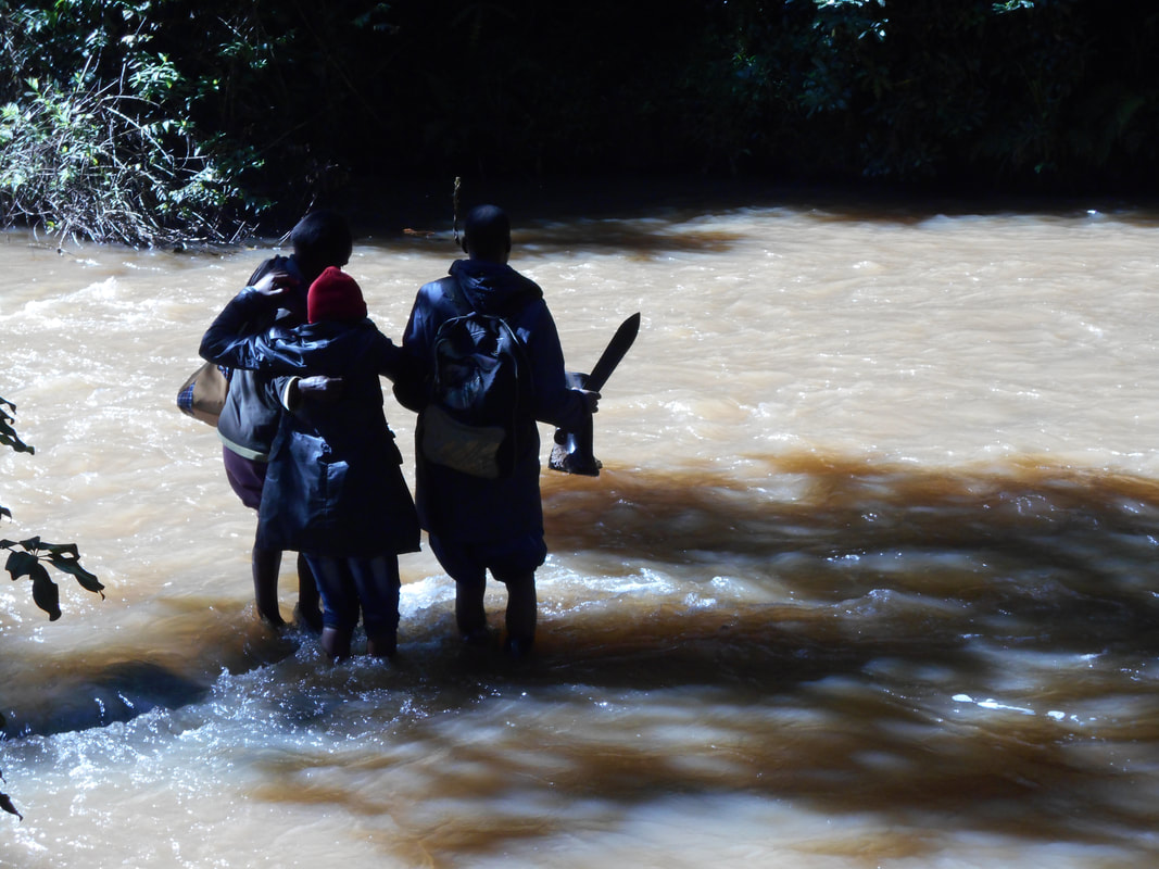
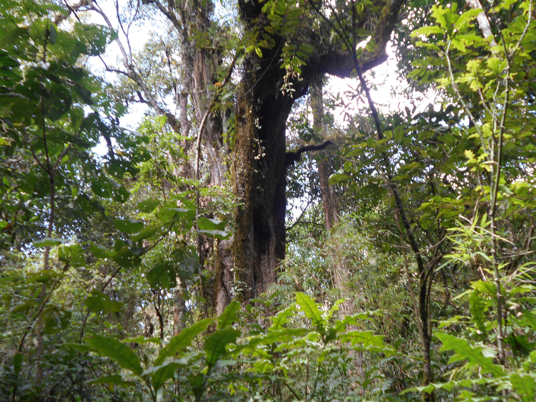
The area, corresponding to the eastern edge of the SOUTH WEST MAU forest block, suffered from a sad story of illegal occupation and consequent violent evictions (2005-2008). The forest, compared to other areas of the same block (KFS forest stations of Mara Mara, kericho, Itare), is ecologically eroded by cattle-grazing, corresponding in practice to the grazing area of the entire block.
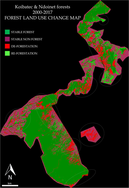
The rapid participatory appraisal was anticipated by a remote sensing analyses assessing the high degree of deforestation and providing reliable and detailed maps of the real forest cover, then used during the participatory mapping activity.
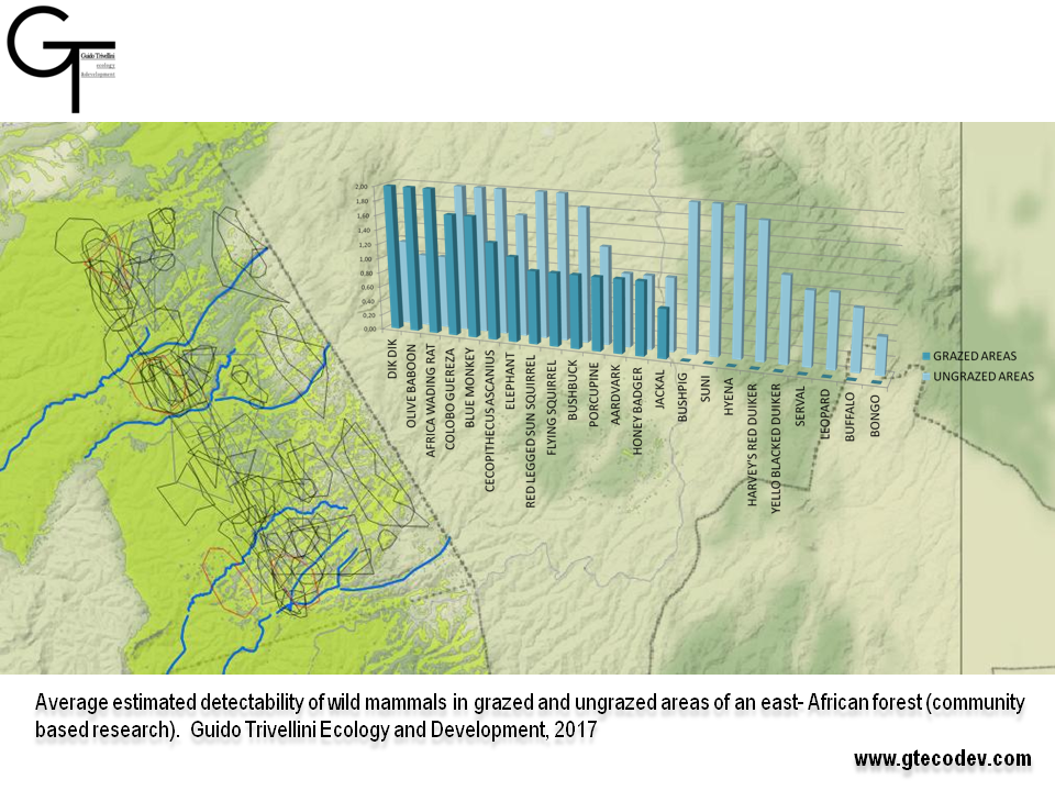
The participatory mapping activity was not only aimed at defining indexes of presence of biodiversity, ecosystem services and Threats (as previously done in Kiptunga forest, 2013-2014), but provided the project with local estimated range of almost 50 mammal and 25 bird species, selected as forest quality indicators on the base of proper scientific literature, as well as of 8 categories of ecosystem services with which the forest provides the community..
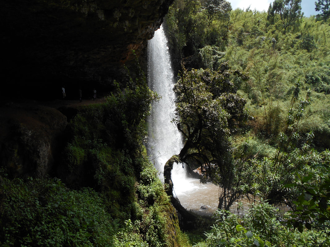
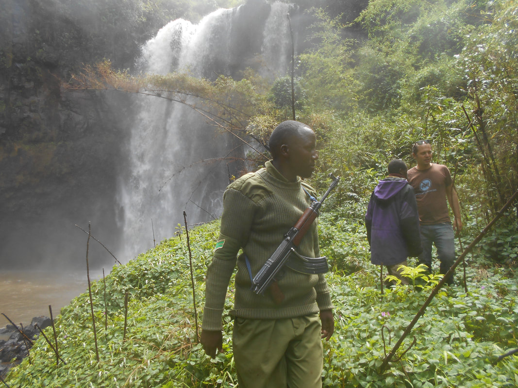
Field activities confirmed the workshop results, as wildlife signs perfectly correlated with participatory maps. Data on tourism-interest location were also collected, identifying entire walking transects in the bush selected for the value of the landscape.
The area, corresponding to the eastern edge of the SOUTH WEST MAU forest block, suffered from a sad story of illegal occupation and consequent violent evictions (2005-2008). The forest, compared to other areas of the same block (KFS forest stations of Mara Mara, kericho, Itare), is ecologically eroded by cattle-grazing, corresponding in practice to the grazing area of the entire block.
The rapid participatory appraisal was anticipated by a remote sensing analyses assessing the high degree of deforestation and providing reliable and detailed maps of the real forest cover, then used during the participatory mapping activity.
The participatory mapping activity was not only aimed at defining indexes of presence of biodiversity, ecosystem services and Threats (as previously done in Kiptunga forest, 2013-2014), but provided the project with local estimated range of almost 50 mammal and 25 bird species, selected as forest quality indicators on the base of proper scientific literature, as well as of 8 categories of ecosystem services with which the forest provides the community..
Field activities confirmed the workshop results, as wildlife signs perfectly correlated with participatory maps. Data on tourism-interest location were also collected, identifying entire walking transects in the bush selected for the value of the landscape.